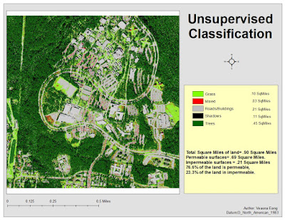
This week we worked in ERDAS to label features in an image under categories. We were able to take the image of the UWF campus and classify it.
The map below is a map that shows the UWF campus. The colors in the legend signify the different land features of the image.

No comments:
Post a Comment